

Garmin Expands Guided Visual Approaches With 12 New Procedures Across Eight Airports
Garmin has announced an expansion of its Guided Visual Approaches database, introducing 12 additional procedures and coverage for eight new airports. The latest update includes several locations in Mexico, further extending the availability of visual approach guidance for pilots operating in challenging airport environments. Developed in collaboration with Hughes Aerospace, the update aims to help pilots maintain more stable approaches and improve situational awareness when navigating airports surrounded by high terrain, obstacles, or complex urban landscapes.
The new additions include Albuquerque, New Mexico (KABQ); Hayden, Colorado (KHDN); and Cabo San Lucas, Mexico (MMSL), along with other airports. The expanded database brings Garmin’s total to 77 Guided Visual Approaches across 56 challenging airport environments. Pilots and aircraft operators can access the updated database through Garmin’s official database distribution platform, flyGarmin.com.
A Familiar Interface for Pilots
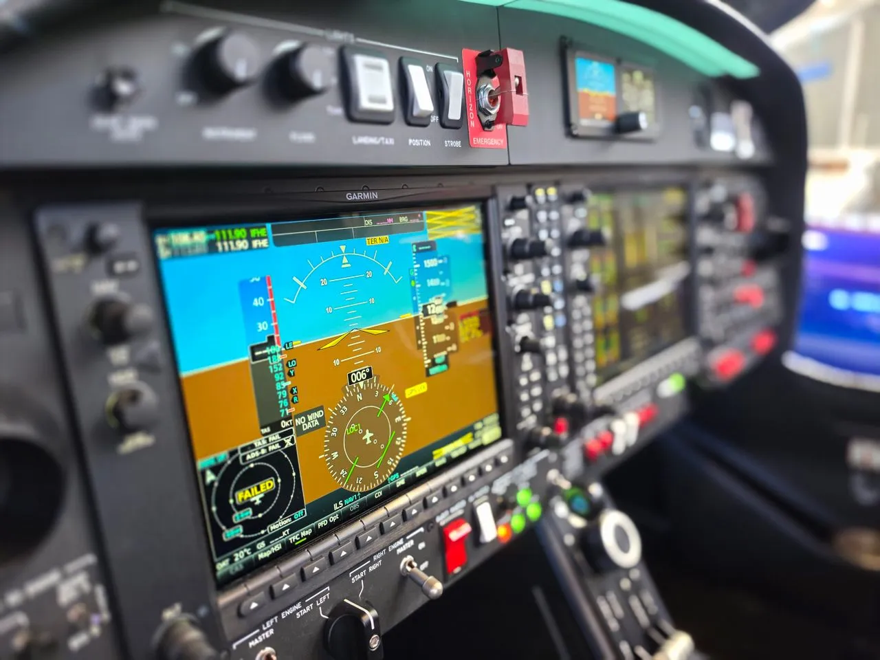
Garmin’s Guided Visual Approaches are designed to provide pilots with an operating experience similar to that of conventional instrument approach procedures. From loading the procedure into compatible avionics to following the approach toward the runway, pilots can use familiar interface elements and guidance displays.
These procedures provide both lateral and vertical guidance, helping pilots maintain the intended flight path during a visual approach. On compatible aircraft and avionics configurations, pilots can also fly the procedures coupled to the autopilot. This capability can reduce the workload associated with manually maintaining the approach path, allowing pilots to devote more attention to outside visual references, surrounding traffic, and runway alignment.
Another important feature is the availability of georeferenced approach charts for all Guided Visual Approaches. These charts help pilots brief the procedure before arrival and follow the approach using a familiar chart presentation. On compatible Garmin avionics, the charts can be accessed in a manner similar to traditional Garmin FliteCharts™. By combining visual references with navigation guidance, Garmin aims to make the briefing and execution of these procedures more consistent with established cockpit workflows.
Supporting Safer and More Stable Approaches
Guided Visual Approaches are intended to assist pilots in situations where a conventional visual approach may require additional attention and precision. Airports located near mountainous terrain, elevated obstacles, or densely developed urban areas can present challenges, particularly when pilots must maintain visual contact with the runway while managing their aircraft’s flight path.
The procedures provide defined lateral and vertical guidance that can help pilots establish and maintain a more stabilized approach. This can be particularly useful when operating faster aircraft, where managing descent rates, speed, and alignment requires careful planning and execution.
Night operations can introduce additional challenges, especially at airports surrounded by city lights and other illuminated structures. In these environments, distinguishing the runway from surrounding lights may be difficult. Guided Visual Approaches provide a defined path toward the runway, helping pilots maintain awareness of their intended approach while continuing to use the required visual references.
Although the procedures offer additional guidance, pilots must continue to comply with applicable visual-flight requirements, operating limitations, and published procedures. The availability of navigation guidance does not eliminate the need for sound judgment, proper approach briefings, or continuous assessment of weather, terrain, traffic, and runway conditions.
Compatibility With Garmin Avionics
Garmin Guided Visual Approaches are compatible with supported Garmin Wide Area Augmentation System (WAAS)-equipped avionics that can fly radius-to-fix (RF) legs. Compatible equipment includes the GTN™ and GTN Xi series navigators, along with selected Garmin integrated flight decks.
RF legs enable aircraft to follow defined curved flight paths, which can be useful when an approach requires a precise turn to align with the runway or navigate around surrounding terrain. This capability supports the structured lateral guidance used by applicable Guided Visual Approach procedures.
However, compatibility depends on the aircraft’s specific avionics installation and approved operating capabilities. Garmin advises aircraft owners and operators to consult the applicable pilot operating handbook or aircraft flight manual to determine whether their aircraft is authorized and equipped to perform required navigation performance (RNP) procedures involving RF legs.
Checking these requirements before using a procedure is essential to ensuring that the aircraft’s equipment and approved operating capabilities match the intended approach.
Guided Visual Approaches in Garmin Pilot
Pilots who use the Garmin Pilot mobile application on compatible Apple® devices can also access Guided Visual FliteCharts. The application allows pilots to view the relevant charts and use them when preparing for an approach.
Guided Visual procedures can also be loaded into a flight plan, allowing the procedure to appear on the moving map alongside other flight-planning information. This provides pilots with another way to review the approach path, understand the relationship between the procedure and the surrounding airport environment, and prepare for arrival.
Integrating these procedures into Garmin Pilot extends access beyond the aircraft’s installed avionics, supporting preflight preparation and approach briefings. Availability and functionality depend on the supported device, application configuration, and applicable subscription or database options.
Convenient Database Purchasing Options
Garmin has made the expanded Guided Visual Approaches database available through flyGarmin.com, using a purchasing process similar to its other aviation database offerings. Customers can select from eligible database packages that include Guided Visual Approaches.
One available option is Garmin’s OnePak™ offering, which combines comprehensive database coverage for compatible Garmin avionics. Depending on the aircraft’s equipment and subscription requirements, these bundled options can help owners and operators manage the data needed across their installed systems.
Pilots and aircraft operators can find additional information about Guided Visual Approaches, supported equipment, and purchasing options at Garmin.com/GuidedVisuals.
Garmin and Hughes Aerospace Collaborate on Aviation Navigation
Garmin develops aviation technologies and services for general aviation, business aviation, rotorcraft, advanced air mobility, government and defense, and commercial air carriers. Its portfolio includes navigation systems, integrated flight decks, flight-planning tools, and safety technologies designed to support pilots and aircraft operators worldwide.
The company has also received the prestigious Robert J. Collier Trophy for Garmin Autoland, an autonomous emergency system designed to take control of an aircraft and bring it to a landing without human intervention when activated under qualifying circumstances.
Hughes Aerospace, headquartered in Houston, Texas, provides air navigation services and specializes in instrument flight procedure design, Performance Based Navigation (PBN) implementation, flight inspection, and heliport, runway, and vertiport certification. Its work supports fixed-wing aircraft, rotorcraft, and advanced air mobility operations.
The collaboration between Garmin and Hughes Aerospace combines avionics technology with specialized flight procedure design to expand access to guided visual approaches at airports where terrain, obstacles, and surrounding development can make arrivals more demanding.
With 12 additional procedures and eight new airports, Garmin’s latest database update increases the reach of Guided Visual Approaches to more locations. The expansion reinforces the company’s focus on providing pilots with navigation tools that support approach planning, situational awareness, and stabilized flight paths in challenging operating environments.
Source Link: https://www.garmin.com/